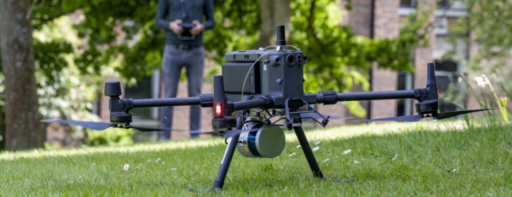
ES@S, with colleagues in Geodata, were commissioned by Natural England to field test a series of UAV mounted sensors to establish the possibilities for monitoring dynamic maritime cliff habitat.
Traditionally surveys of soft and vertical cliff sites in England have been extremely limited, either being undertaken by desk-based methods i.e. measuring length from OS maps and assessing habitat using aerial photographs; or small-scale field visits where the habitat is viewed from a distance using binoculars or by roped ecologists.
Survey work is often difficult to undertake with the harsh environment (extreme weather, waves and terrain) making it difficult to reach and survey safely. More recent surveys have used a mixture of aerial photograph and site visits, with the collection of vegetation data limited to accessible, stable slopes where risks can be managed. This means there are sections of cliff where data is not available. This proof-of-concpet project looked to trial the use of Uncrewed Aerial Vehicles (UAVs) and satellite technology to capture data on vegetation and habitat condition specifically on inaccessible coastal cliffs whether these are high and vertical or soft and instable.
ES@S designed and undertook trials at two UK coastal cliff locations: Reighton Sands in North Yorkshire and Mullion on Cornwall.
UAV mounted environmental sensors
For this project we deployed multiple platforms and sensors, inlcuding a UAV based LiDAR unit, a traditional RGB camera, and a multispectral camera, with a view to assessing how we can best combine the data to detect and classify vegetation and bare earth.
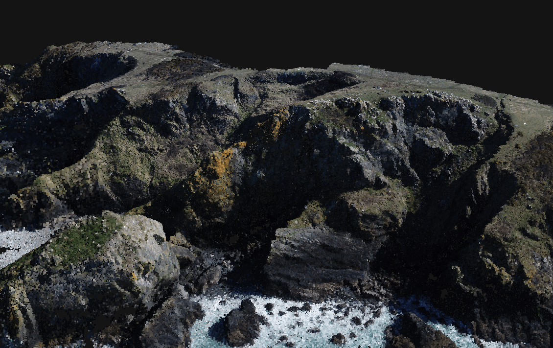
RGB data was used to create a ~1 cm resolution orthophoto of the cliff site, as well as used to recreate a 3D model using Structure-from-Motion (SfM) techniques using Pix4D. The resultant point cloud consists of >34 M points, with a ground density of >1100 points per square metre. Have an explore of the dataset below.
“UAVs, with the right sensors onboard, have the potential to revolutionise how we capture important coastal monitoring data to better establish geomorphological change, habitat dynamics and associated risk”
Prof. Chris Hill, GeoData Project Lead
Testing approaches to classifying vegetation
ES@S has extensive experience of using remote sensing techniques to better monitor, model and understand vegetation and ground dynamics. Due to the complexity of the coastal cliff environment, including the rough terrain and combination of short and larger, scrubby vegetation, we tested a variety of classification techniques and algorithms to feed into the GeoData report.
Whilst traditionally, orthomosaic photos are used with classification techniques, these struggle to differentiate some vegetation classes. Here we developed a classifcations which made use of the LiDAR height data and structural metrics, coupled with the RGB imagery to create a more robust classification.
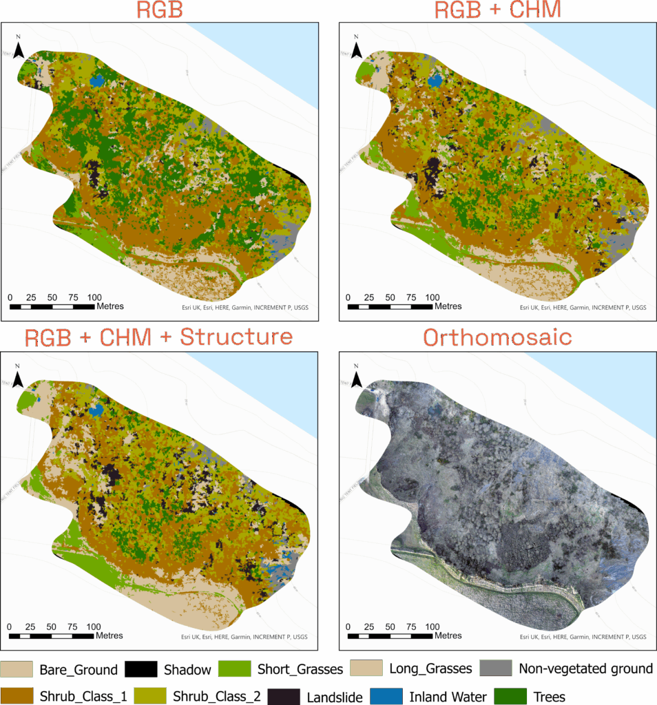
The inclusion of canopy height in the above example makes a significant difference to the outputs of the classification, reducing the incorrect classification of many areas of the site being labelled as having trees, and also improving the proportion of areas correctly identified as grasses.