
At the beginning of this year, the Environmental Sensing @ Southampton team supported baseline surveying of Holes Bay on behalf of Bournemouth, Christchurch and Poole Council.
Holes Bay, Poole
Holes Bay is an intertidal wetland within Poole Harbour in the south of England. Over time, its wetland area has diminished due to a combination of natural processes and human pressures. Wetlands such as this are vital habitats for numerous bird species that rely on the mudflats, function as nutrient sinks for flows from the wider Poole Harbour catchment, and offer natural bank protection.
Surveying
ES@S was approached by Rob Clarke from Bournemouth, Christchurch, and Poole Council to support survey work ahead of planned wetland restoration. The aim was to establish a baseline of the site’s morphology and map the extent of its saltmarsh using multiple survey methods. ES@S was uniquely equipped for this task, combining aerial data collection from UAS (Uncrewed Aerial System, or drone) platforms with USV (Uncrewed Surface Vehicle, or autonomous -boat) bathymetric surveys in areas inaccessible to aerial platforms.
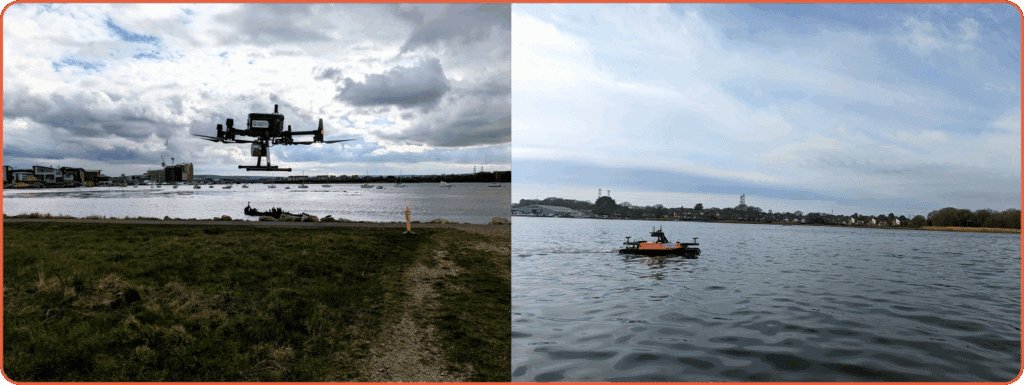
Over six days in the field, data was gathered using both aerial and boat-based platforms, with the UASs capturing LiDAR and high-resolution imagery, and the USV collecting multi-beam bathymetric data. This required careful coordination of site access, boat hire, and tide schedules to maximise coverage. In addition, a number of sediment samples were collected from across the site for grain-size and nutrient analysis.
Outputs
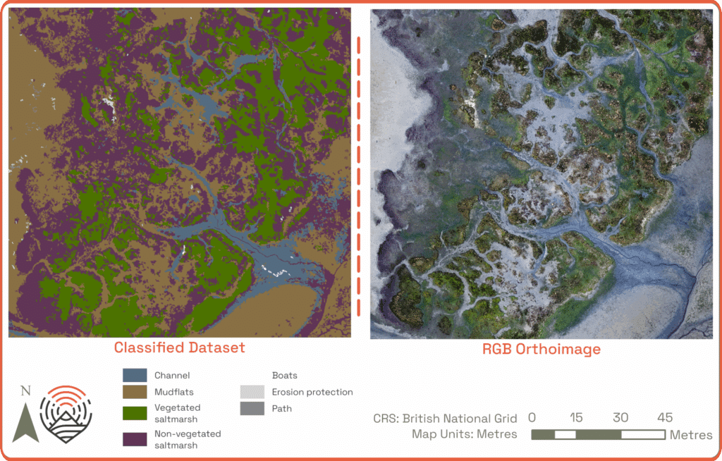
Once processed, the datasets were merged to produce continuous models of the bay, enabling future comparison and change detection following restoration works. The datasets can be explored here Interactive Display – Holes Bay and in the below inset.
Additional outputs included measurements of saltmarsh vegetation height, assessments of vegetation health using multispectral imagery, and a broad habitat classification that mapped the extent of mudflats and saltmarsh (image 3). The collected datasets aligned to within 0.03 m of one another when compared to independent check points.
Rob Clarke commented he was “very happy to have contracted ES@S to carry our detailed baseline surveys of the Holes Bay saltmarsh”, and that “the data will provide a significant contribution to the scheme in determining the best method for restoring saltmarsh in the bay”.
This project demonstrated ES@S’s capability to capture high-quality data at the land-water interface, providing BCP Council with a robust dataset to guide restoration planning and track changes over time, helping to ensure the long-term success of their work.
To find out more about what ES@S can offer, e-mail us at esas@soton.ac.uk, visit us on LinkedIn https://www.linkedin.com/company/esas-southampton, and check out our website for more on our projects and capabilities at https://esas.soton.ac.uk/insights/.