ES@S is pleased to be involved in UKRI funded research which is seeking to discover the hidden landscapes adjoining the River Avon, on the edge of the Stonehenge World Heritage Site.
The Neolithic and Bronze Age construction and habitation of Stonehenge is well documented through a wealth of previous research. However, there is still considerable debate amongst experts as to the scale of pre-Neolithic activity and whether the Stonehenge monument was constrcuted in an otherwise empty landscape.
In this UK Research and Innovation (Arts and Humanities Research Council) funded project, the team are seeking to establish whether the area surrounding Stonehenge shows signs of being occupied by earlier settlers.
ES@S (via director, Prof. Julian Leyland, and technical specialist, Dr Chris Tomsett) are involved as a research partner and have been commissioned to capture and process data for a range of sites, including one of the River Avon at Durrington, as shown below.
View Larger Map
Deploying the LiDAR drone
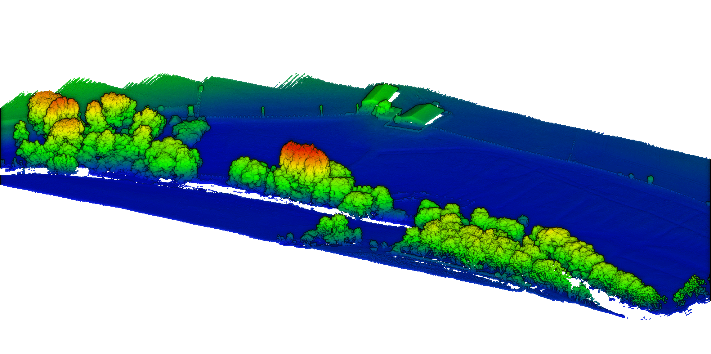
For this project we deployed the Topolidar unit using our DJI M300 RTK platform, providing a robust solution for the capture of high resolution topographic data.
The Topolidar, based on a Velodyne VLP16 unit, is perfect for this job as it has shown to result in better penetration through the vegetation canapoy than e.g. the DJI L1 sensor.
The ES@S field team, along with project Research Fellow, Dr Ben Pears, deployed the equipment and undertook a pre-planned survey flight and some additional flight lines to allow for survey alignment error calculations.
“LiDAR will allow us to look beneath the modern vegetation, revealing possible historical river courses”
Prof. Tony Brown, Project Lead
Using our post-processing expertise
ES@S uses a combination of off-the-shelf and bespoke data processing tools to deliver the required insights for the specific job in hand.
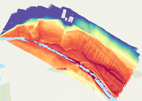
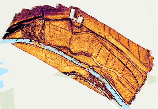
Here the team wish to explore the ‘bare earth’ landscape for possible signs of human interferance, so we applied filters to remove vegetation, resulting in a point cloud consisting of over 57 million points.
In addition, as the site is sloping towards the river and along the river we detrended the output Digital Terrain Model, to remove the slope trends. This helps by allowing us to focus on subtle changes in slope and topography that might otherwise be obscured and to produce slope maps for further analysis.