Processing & Interpretation
Working at the cutting edge
ES@S is actively engaged in developing the tools and processes which drive forwards environmental sensing applications
We are actively engaged in a combination of UKRI, government and commercially funded projects. Most work with us as they need state-of-the-art platforms and sensors, coupled with expert knowledge of the environment in which they are being deployed. We are so much more than a survey company, providing expert insight into the underlying processes and functioning of an environmental system.
Developing bespoke workflows for your data
ES@S will establish how best to collect and process the data required for your research project or commercial job.
You might already work with a certain data format, or you may never have worked with 3D point cloud data before. Either way, we will establish the scope of data delivery and possible training requirements at the outset of our relationship.
Leading the field
We’ve been using a combination of industry standard, Open Source and bespoke software for many years
Whilst some specialist equipment requires expensive licensed software, wherever possible we prefer to make use of, and help to develop, Open Source software and tools. Similarly, we have expertise in industry standard ArcGIS pro, as well as QGIS.
In addition, we often need to develop bespoke code and workflows for processing of data (see Advanced Analysis) and where possible we publish and share this for use by the wider community.
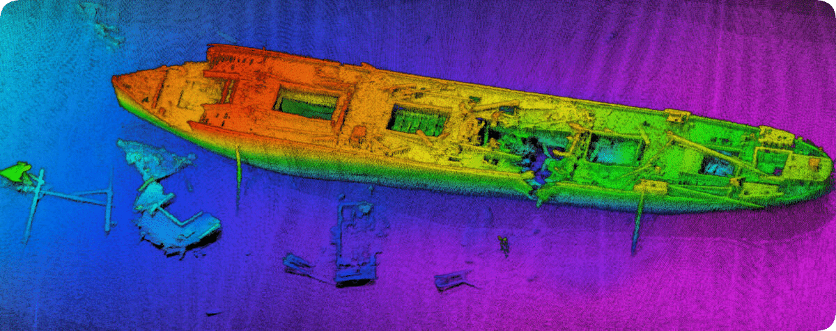
Get in touchDelivery of complex 3D data
Whatever your data type and size, we’ll find the best way to deliver what you need.
Data delivery can be via a range of formats and methods, depending upon your requirements and expertise. For those wishing to undertake further manipulation and analysis, we might recommend the use of excellent open source software such as CloudCompare. For others, we may deliver your data via our ES@S Pix4D cloud client portal – click here to see an example.
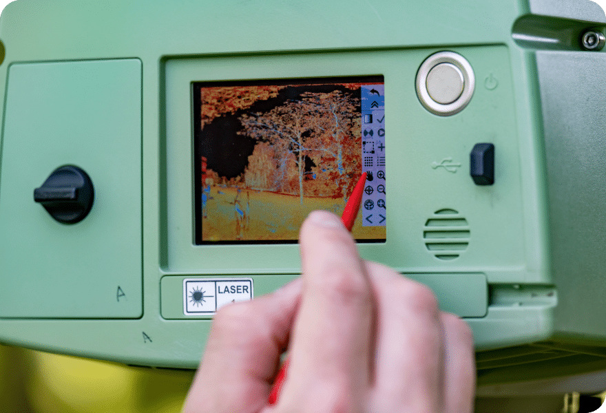
Data processing is essential
Raw survey data nearly always requires a basic level of processing and Quality Assurance (QA) to ensure it is fit for purpose
With the increased use of complex autonomous platforms and programmed surveys huge quantities of data can be collected very rapidly. However, this data often needs a degree of basic post-processing, for example Precise Point Kinematic processing to refine positional data on UAV LiDAR or MultiBeam surveys, or registration of multiple ground based laser scans. In addition, Quality Assurance steps should aways be undertaken to check the accuary and errors associated with measured data.

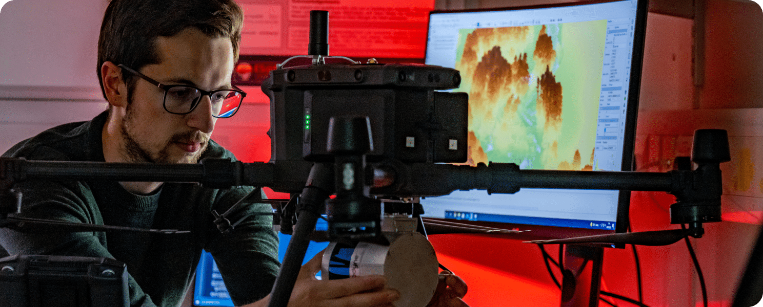
Advanced analysis
We are driven by a passion to understand natural processes.
This means that we are usually collecting hydrographic data or aerial imagery with an end-goal in mind. For example, to establish above ground biomass of a forest, not only do we require high resolution 3D survey data, we also need to undertake a series of advanced processing steps to classify the point cloud.
ES@S has experience of developing workflows, for example to investigate eco-geomorphic feedback mechanisms (how vegetation and rivers co-evolve), or combining multiple datasets to explore mega-river processes. We can bring this expertise to your project and data. Contact us if you wish to discuss the possibilities.
Get in touchNeed advice? Want to discuss your project?
ES@S is happy to consult across a range of sectors and disciplines. We have worked with a diverse set of clients ranging from engineers to psychologists!
To discuss how we can help you…
Get in touch
Hydrographic Survey
Etiam interdum egestas tincidunt. Etiam vel dolor scelerisque, consectetur nulla et.
Etiam interdum egestas tincidunt. Etiam vel dolor scelerisque, consectetur nulla et, accumsan enim. Cras ac dui sapien. Sed sed suscipit felis. Pellentesque sit amet hendrerit ligula. Nulla porta
Etiam interdum egestas tincidunt. Etiam vel dolor scelerisque, consectetur nulla et, accumsan enim. Cras ac dui sapien. Sed sed suscipit felis. Pellentesque sit amet hendrerit ligula. Nulla porta
Learn MoreLorem Ipsum
Etiam interdum egestas tincidunt. Etiam vel dolor scelerisque, consectetur nulla et.
Etiam interdum egestas tincidunt. Etiam vel dolor scelerisque, consectetur nulla et, accumsan enim. Cras ac dui sapien. Sed sed suscipit felis. Pellentesque sit amet hendrerit ligula. Nulla porta
Expertise
From microscopic detail to global analysis – we know what we are talking about
We have access to some of the world’s leading experts in remote sensing, hydrology, ecology and marine dynamics to name a few.
Learn More